Enfield Town to Ponders End Station Walking and Cycling Route
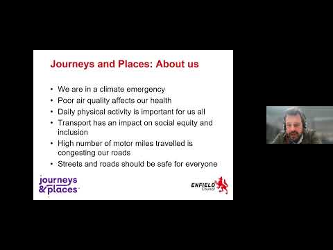
As part of the Journeys and Places programme, Enfield Council is continuing to develop a network of active travel routes in Enfield to encourage more people to walk and cycle in the borough. Enfield Council is proposing a walking and cycling route from Enfield Town to Ponders End Station, which is funded by Transport for London (TfL).
Currently there are numerous active travel routes that run from north to south throughout the borough. However, there are limited east to west routes to connect the existing facilities to one another. The Enfield Town to Ponders End Station Walking and Cycling Route would help address this issue as it would connect to the walking and cycling route which has been introduced along Ponders End High Street (Cycleway 1) and the proposed Enfield Town to Broxbourne Walking and Cycling Route project via the proposed Enfield Town improvements project. Ultimately, this project would be a part of a larger east-west network to create a future strategic cycle corridor.
The proposed route starts at the eastern side of the Southbury Road / Willow Road junction and reaches Ponders End Station via Alma Road. The total length of the proposed route (subject to confirmation of the preferred alignment) is approximately 3.9 kilometres.
The proposed route aims to:
- Provide a quieter, safer, and more pleasant route that will encourage people to use active travel modes for more of their journeys.
- Reduce the volume of motor traffic on the section of Main Avenue outside Bush Hill Park Primary School.
- Provide a safe cycle facility across the A10.
- Promote cycling along car-free areas such as though Bush Hill Park and Ponders End Park.
On this project page you can find:
- Key project dates in the Key Dates section on the right-hand side.
- Project updates in the News Feed below.
- A Document Library on the right-hand side which contain key documents.
- An FAQ section on the right-hand side which contain a list of frequently asked questions.
-
Bush Hill Park Construction Update June 2024
Share Bush Hill Park Construction Update June 2024 on Facebook Share Bush Hill Park Construction Update June 2024 on Twitter Share Bush Hill Park Construction Update June 2024 on Linkedin Email Bush Hill Park Construction Update June 2024 link
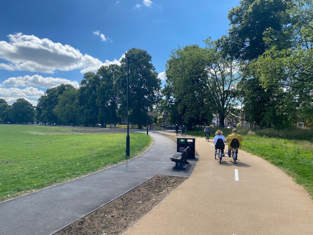
We are pleased to announce that the works in Bush Hill Park are now complete, and the new infrastructure is open for the public to use.
There are still some minor snagging items that will be picked up by our contractor in the coming weeks, however the park will remain open while this is completed.
We would like to thank you for your patience while we carried out the construction works in Bush Hill Park.
All Ability Cycling Hub
The All Ability Cycling Hub has now returned to normal, operating on Mondays from 10am-3pm and Fridays from 10am-2pm (Fridays run until the end of September) via the new path. As such new members can be catered for again.
-
Bush Hill Park Construction Update May 2024
Share Bush Hill Park Construction Update May 2024 on Facebook Share Bush Hill Park Construction Update May 2024 on Twitter Share Bush Hill Park Construction Update May 2024 on Linkedin Email Bush Hill Park Construction Update May 2024 link
We are approaching the end of the construction works in Bush Hill Park. Our contractors are currently completing the works on the southern path and then inspections can be carried out on the new infrastructure prior to opening.
Unfortunately, due to inclement weather early on in the programme, our finish date has been delayed to June, rather than May as originally specified.
We anticipate that our contractors will open the new path in the early part of June, and we will notify when the park is fully open to the public again.
We apologise for the inconvenience this delay has caused.
Should you have any queries about these works, please contact the Journeys and Places team at JourneysandPlaces@enfield.gov.uk
All Ability Cycling Hub
The All Ability Cycling Hub is still operating in Bush Hill Park on Mondays from 10am – 3pm and Fridays from 10am – 2pm using a different route, however due to the construction works we are unable to cater to new members at present. When the works are completed, the Hub will resume as normal and new members will be catered for again. We apologise for any inconvenience this may cause.
-
Bush Hill Park Construction Update March 2024
Share Bush Hill Park Construction Update March 2024 on Facebook Share Bush Hill Park Construction Update March 2024 on Twitter Share Bush Hill Park Construction Update March 2024 on Linkedin Email Bush Hill Park Construction Update March 2024 link
Since our previous update on the works in Bush Hill Park in February 2024, our contractors have completed works along the western section of the park, from the Cross Road entrance to the western entrance to the park on Lincoln Road. Lighting columns have also been installed along this section of the park.
Works currently underway
Works are currently underway to upgrade the existing path between the two entrances on Lincoln Road. Our contactors will then proceed to install the lighting columns along this section of the path once complete.
Upcoming works
When the above works are completed, our contractors will move on to the final phase of construction in Bush Hill Park, which includes installing lanterns on the lamp columns, planting turf/wildflower, and generally tidying up the park in anticipation of the new path being opened for public use.
We will continue to post updates as the works in Bush Hill Park progress.
Should you have any general queries about these works, please contact the Journeys and Places team at JourneysandPlaces@enfield.gov.uk
All Ability Cycling Hub
The All Ability Cycling Hub is still operating in Bush Hill Park on Mondays from 10am – 3pm using a different route, however due to the construction works we are unable to cater to new members at present. When the works are completed, the Hub will resume as normal and new members will be catered for again. We apologise for any inconvenience this may cause.
-
Bush Hill Park Construction Update February 2024
Share Bush Hill Park Construction Update February 2024 on Facebook Share Bush Hill Park Construction Update February 2024 on Twitter Share Bush Hill Park Construction Update February 2024 on Linkedin Email Bush Hill Park Construction Update February 2024 link
The works in Bush Hill Park commenced on 22nd January and our contractors are currently working on the section of the route which is situated in the north-west corner of the park at Cross Road.
Works currently underway
Works currently underway include the closing of the existing entrance to the park on Cross Road and the opening of a new, wider entrance to the park approximately 15m to the west of the existing entrance. A new path will be constructed to accommodate this new entrance which will re-join the existing path approximately 50m south of the new entrance. Ducting will also be installed to enable the installation of new lighting columns later in the construction phase.
Upcoming works
When the above works are completed, our contractors will move on to the next section of the route. This section of the route is located along the western side of the park, up to the western entrance on Lincoln Road.
The works will include upgrading the existing path at this location and the installation of ducting to enable new lighting columns to be installed later in the construction phase.
We will continue to post updates as the works in Bush Hill Park progress.
Should you have any general queries about these works, please contact the Journeys and Places team at JourneysandPlaces@enfield.gov.uk
All Ability Cycling Hub
The All Ability Cycling Hub is still operating in Bush Hill Park on Mondays from 10am – 3pm using a different route, however due to the construction works we are unable to cater to new members at present. When the works are completed, the Hub will resume as normal and new members will be catered for again. We apologise for any inconvenience this may cause.
Document Library
-
 Traffic Orders
-
Statutory Consultation Plans - NOVEMBER 2024
-
 Enfield Town to Ponders End Walking & Cycling Route - Scheme Map November 2024 (1.49 MB) (jpg)
-
Enfield Town to Ponders End Walking & Cycling Route - Revised Proposals November 2024 (2.17 MB) (jpg)
-
Eaton Road to Bush Hill Park - TMO Drawings (1.2 MB) (pdf)
-
Percival Road, Bertram Road, and Clive Road - TMO Drawings (1.35 MB) (pdf)
-
Enfield Town to Ponders End Walking & Cycling Route A1 Boards (9.33 MB) (pdf)
-
-
Controlled Parking Zone (CPZ)
-
Key project documents
-
Letters and reports
-
Project Update - November 2024 (7.57 MB) (pdf)
-
Letter to residents January 2023 (601 KB) (pdf)
-
Engagement Summary Report August 2023 (1.14 MB) (pdf)
-
Letter to residents November 2023 (291 KB) (pdf)
-
Enfield Town to Ponders End Walking & Cycling Route Project Update - October 2024.pdf (7.57 MB) (pdf)
-
Enfield Town to Ponders End Station - Statutory Consultation Letter Nov 2024.pdf (620 KB) (pdf)
-
Enfield Town to Ponders End Station - Works Notification Letter Feb 2025.pdf (204 KB) (pdf)
-
-
Proposed plan - November 2023
-
Proposed plan - Enfield Town to Ponders End Station Walking and Cycling Route - NOVEMBER 2023 (2.86 MB) (jpg)
-
Location Plan - NOVEMBER 2023 (2.92 MB) (pdf)
-
Southbury Road section - NOVEMBER 2023 (7.57 MB) (pdf)
-
Eaton Rd, Seaford Rd, Fotheringham Rd, Cross Rd section - NOVEMBER 2023 (8.52 MB) (pdf)
-
Bush Hill Park section - NOVEMBER 2023 (10.1 MB) (pdf)
-
Lincoln Road section - NOVEMBER 2023 (28.2 MB) (pdf)
-
Percival Rd, Bertram Rd, Clive Rd section - NOVEMBER 2023 (9.7 MB) (pdf)
-


Videos


Who's Listening
-
Enfield Council